

2017/12/22NEW
Hashima's transformation shown through coal mine land maps over time
Here, we will trace Hashima’s transformation over time, by looking at maps of the island from different generations. The maps show us what Hashima was like up until the end of the war.
Source: “Preservation Plan for Historical Site: Takashima Coal Mine - Takashima Hokkeiseiko Mine Site / Nakanoshima Mine Site / Hashima Mine Site”, Nagasaki City Board of Education.
1897 ~1907
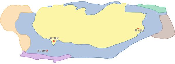
The Mitsubishi Company, which purchased Hashima in 1890, developed Shaft #2 and Shaft #3, expanding the size of the island.
Source: Map based on "Hashima Mine Overview", 1953, Mitsubishi Mining Company, Takashima Coal Mine
1917
Shaft #2 was used to transport people in and out of the pit, and for exhausting air; Shaft #3 was used to transport coal and materials, and for intaking air. Steam and electrical power were used to move machinery.
Source: Map based on “Takashima Coal Mine Hashima Mine Report” (Maps in separate volume) by Yoshio Yamada, 1918, owned by Kyushu University
1921
In addition to Shaft #2 and Shaft #3, Shaft #4 was opened, which was also used for manufacturing salt.
Source: Map based on “Takashima Coal Mine Hashima Mine Practical Research Report” (maps included), by Minoru Kumabe, 1922, owned by Kyushu Institute of Technology
1928
Shaft #2, Shaft #3, and Shaft #4 began operating simultaneously, and the Futako power plant began transmitting power to the coal mine.
Source: Map based on “Mitsubishi Takashima Coal Mine Hashima Mine Practice Report” by Naoki Minoda, 1930, owned by Kyushu Institute of Technology
1937
By this time, Shaft #2 was regularly used for intaking air and Shaft #4 was used for exhausting air; sorting, stocking, and loading facilities were improved.
Source: Map based on “Takashima Coal Mine Hashima Mine Practice Report” by Chizuo Shion, 1938, owned by Kyushu University
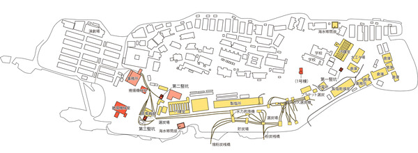
1939
A large-scale boarding house for workers was built.
Source: Shimizu Corporation Building Construction Design Document, November 11, 1939
Post-war
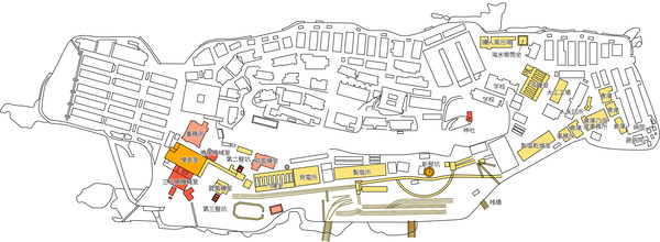
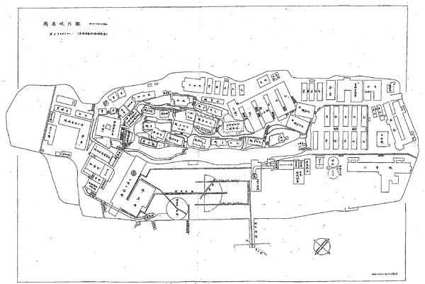
1946〜1948
As reconstruction efforts progressed after the war, an organized production system was put in place.
Source: Map based on “Mitsubishi Takashima Hashima Coal Mine Report” by Tadao Shirakura, 1951, owned by Kyushu University
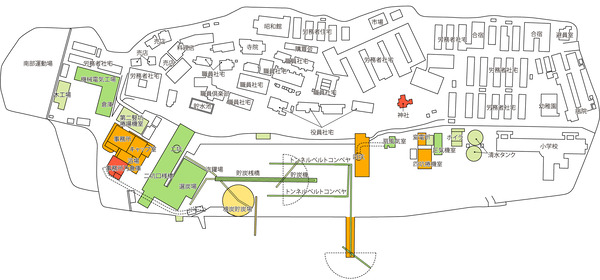
1955
Shafts were further deepened, and sorting, stocking, and loading of coal were mechanized.
Source: Map based on “Mitsubishi Takashima Coal Mine Takashima Mine Practice Report” by Kiwami Matsunaga, 1955, owned by Kyushu University
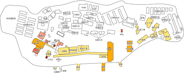
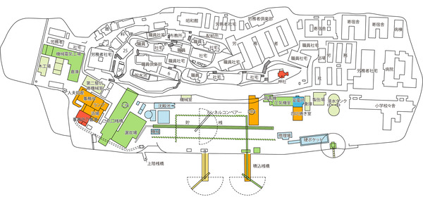
1974
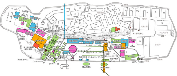
New technology, such as mechanizing coal exploitation in the Mitsuze area, was introduced around this time; however, there were also setbacks, caused by the occurrence of spring water and hydrogen sulfide gas.
Source: Map based on “History of the Dissolution of the Gunkanjima Hashima Labor Union”, 1966, by Hashima Labor Union
The Hashima Coal Mine was officially closed on January 15th, 1974
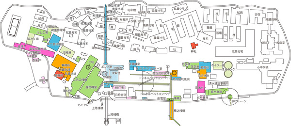
Current Map
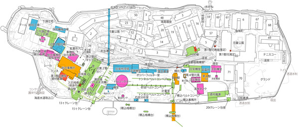
Source: Map based on “Takashima Coal Mine Investigative Report”, and the current Hashima topographical map, 2014, Nagasaki City